Photos
Enter a word or phrase to perform a general search across all records in the Photos catalog. You can also browse records in the catalog without performing a search.
Search Tips
- Searches are not case sensitive.
- Searching for multiple words connects them with OR by default. Matching records can contain any of the words.
- Connect multiple words with AND if you only want to see records containing both words.
- Use quotation marks to search for a phrase.
- Place an asterisk (*) at the end of a word as a wildcard.
7492 results found. Records searched: 7492
-
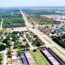
2023.84.45 - Photograph, Color
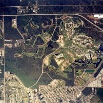
Color. Lely is located in western Collier County and is bordered on the southwest by US 41, on the south by Naples Manor, and on the southeast by Lely Resort.
Record Type: Photo
-
2023.84.463 - Photograph, Color
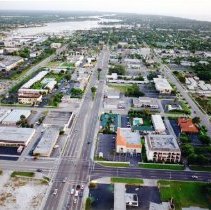
Color. Aerial view of the Airport Pulling Road and Immokalee Road intersection looking toward the Gulf of Mexico. Green Tree Center shopping plaza in the center.
Record Type: Photo
-
2023.84.464 - Photograph, Color
Color. Aerial view of Airport Pulling Road from Orange Blossom Drive, foreground, to Vanderbilt Beach Road, background. St. Katherine Greek Orthodox Church is the orange-domed building on the right side.
Record Type: Photo
-
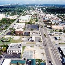
2023.84.466 - Photograph, Color
Color. Aerial view of Airport Pulling Road from Pine Ridge Road, foreground, to Coronado Drive, background. Sports Authority, now El Dorado Furniture, in the bottom right, and Lowe's in the back left.
Record Type: Photo
-
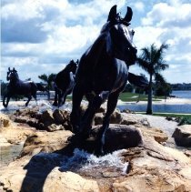
2023.84.47 - Photograph, Color
Color. "Lely Freedom Horse" statues are 1,000 pound bronze statues that are 1¼ life size. The horses were commissioned in 1992 by renowned artist/sculptor Veryl Goodnight of Colorado. The commissioning agreement gave the artist the ownership of the original molds for duplication. The Lely Freedom Horses have been replicated twice and are on display at the George H.W. Bush Presidential Library in Texas and the Berlin Freedom Memorial in Ger...
Record Type: Photo
-
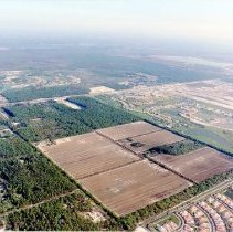
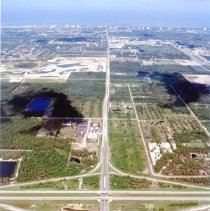
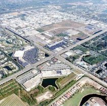
2023.84.471 - Photograph, Color
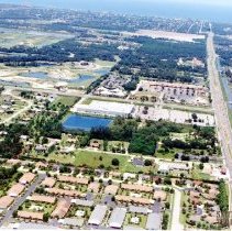
Color. Aerial view of the Collier Boulevard and Immokalee Road intersection, middle right, taken from Logan Boulevard looking northeast. Cleared area is now the Saturnia Lake community.
Record Type: Photo
-
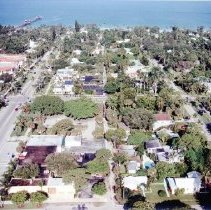
2023.84.475 - Photograph, Color
Color. Aerial view of downtown Naples and the area between Broad Avenue South and 11th Avenue South. Naples pier in the background.
Record Type: Photo
-
2023.84.478 - Photograph, Color
Color. Aerial view of Goodlette Frank Road looking north. Naples Playhouse in the foreground, now the site of Bayfront.
Record Type: Photo
-
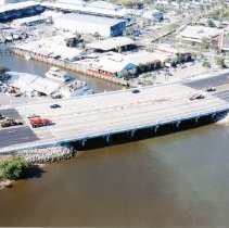
2023.84.481 - Photograph, Color
Color. Aerial view of the Gordon River Bridge. Kelly's Fish House on the left and Tin City on the right.
Record Type: Photo
-
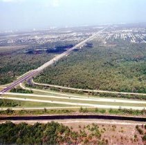
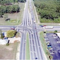
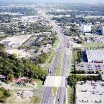
2023.84.494 - Photograph, Color
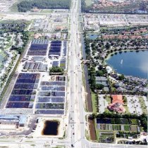
Color. Aerial view of the Pine Ridge Road exit of I-75 looking west.
Record Type: Photo
-
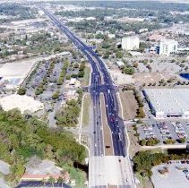
2023.84.495 - Photograph, Color
Color. Aerial view of the Immokalee Road exit of I-75 looking west.
Record Type: Photo
-
2023.84.499 - Photograph, Color
Color. Aerial view of the Pine Ridge Road and Goodlette Frank Road intersection looking north. Pine Ridge Middle School in the top right corner with baseball fields in the background.
Record Type: Photo
-
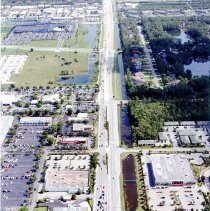
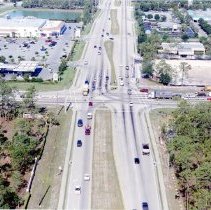
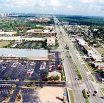
2023.84.501 - Photograph, Color
Color. Aerial view of the Pine Ridge Road and Airport Pulling Road intersection. Carillon Place is the shopping center in the foreground and Pine Ridge Crossing is the shopping center across the street.
Record Type: Photo
-
2023.84.513 - Photograph, Color
Color. Aerial view of the Santa Barbara Boulevard and Golden Gate Parkway intersection.
Record Type: Photo
-
2023.84.514 - Photograph, Color
Color. Aerial view of the Santa Barbara Boulevard and Radio Road intersection. Berkshire Commons on the right and Countryside Shoppes on the left.
Record Type: Photo
-
2023.84.515 - Photograph, Color
Color. Aerial view of Tamiami Trail looking north. Central Avenue is in the center with the square crosswalk.
Record Type: Photo
-
2023.84.516 - Photograph, Color
Color. Aerial view of Tamiami Trail looking north and the Gulf of Mexico on the left side. Park Shore Plaza is on the left.
Record Type: Photo
-
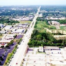
2023.84.517 - Photograph, Color
Color. Aerial view of Tamiami Trail East looking towards the Gulf of Mexico. Walmart is on the right side and the Collier County Government Center is behind it.
Record Type: Photo
-
2023.84.518 - Photograph, Color
Color. Aerial view of Tamiami Trail East looking towards the Gulf of Mexico. Walmart is on the right side and the Collier County Government Center is behind it.
Record Type: Photo
-
2023.84.522 - Photograph, Color
Color. Aerial view of the Tamiami Trail East and 3rd Avenue South intersection looking south towards 5th Avenue. Tin City located in the top left corner.
Record Type: Photo